Fantasy Map Generator AI: Continents, Kingdoms & Battle Maps
2026-09-14
Jenova helps you turn a gazetteer paragraph into a continent you can actually run—mountains that feed rivers, coasts that invite ports, and cities that sit where a road would really go. In September 2026, more tables play on virtual tabletops and more novels open with a map the reader is meant to trust. A fantasy map generator AI on this platform pairs image generation with specialist agents so a gothic highland, a turquoise archipelago, or a river empire stays one world from wall poster to battle map.
✅ Continent and region maps from a written world bible ✅ Style control for antique charts, isometric isles, and painterly campaign art ✅ Lore, play, and recap agents that reuse the same geography ✅ Full use on web, iOS, and Android with synced history
To understand why this matters, it helps to look at why most generated maps fail as places you can actually play—and why a pretty picture is not the same as a setting.
Quick Answer: What Is a Fantasy Map Generator AI?
A fantasy map generator AI is a tool that turns worldbuilding descriptions into illustrated maps—continents, kingdoms, cities, and battlefields—you can use in campaigns, novels, and virtual tabletops. It is not only a random landmass machine. It is a way to keep one world’s geography recognizable from the endpaper to the encounter grid.
Key capabilities:
- Continent, region, city, and battle-scale views from one geography bible
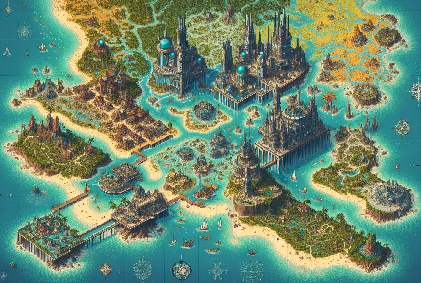
- Cartographic styles from portolan charts to isometric island kingdoms
- Gazetteers, travel routes, and faction borders that match the art
- Play and recap follow-through with Roleplay Game Master on the same terrain
Why Fantasy Maps Fail Before Session Zero
A setting map is not decoration. Fantasy cartography is the design of maps that present an imaginary world—or that recast a real place as fiction. Players use it to plan routes, argue borders, and remember where the dragon actually lives. Readers use it to believe the journey.
That job is getting more public, and more digital. Industry estimates put the global tabletop role-playing game market at USD 2.31 billion in 2025. Broader tabletop games were already a USD 19.50 billion market in 2024, with forecasts toward USD 34.10 billion by 2030. Digital play is a large part of that shift: one market report values digital tabletop platforms at $3.8 billion in 2025, with an 11.6% CAGR toward $10.2 billion by 2034.
USD 2.31 billion — Reported global TTRPG market size in 2025
$3.8 billion — Reported digital tabletop platforms market in 2025
Commentary on TTRPG trends treats virtual tabletops such as Roll20, Foundry VTT, and Fantasy Grounds as a default mode of play, not a niche. Those tables need maps that crop, grid, and still look like the same kingdom when the party leaves the hex crawl for a 30-foot courtyard.
But getting a map that is both beautiful and usable is frustratingly difficult:
- Generic image models ignore hydrology, climate, and scale
- One continent painting is not a region map, city map, or battle map
- Labels, compass roses, and legends drift or become unreadable
- Procedural tools and stamp editors solve different jobs than campaign art
- Geography, lore, and the session itself still live in disconnected apps
The land looks epic and physically wrong
Rivers do not fork uphill. Forests do not ignore rain shadows. Coasts need harbors, and deserts need a reason. Worldbuilders repeating
start from a blunt rule: rivers run from high ground toward the sea, sourced in mountains, hills, lakes, or glaciers. Guides to fantasy map making make the same point—read how mountains and rivers form before you draw a border.A diffusion model does not know that. It knows what “fantasy map” looks like in training data: jagged ranges, decorative compasses, a castle on a crag. Without a geography bible, you get a poster that collapses the first time a player asks which way the river flows.
One image is not a map set
A campaign needs several scales. The endpaper continent shows biomes and kingdoms. The regional sheet shows roads, forts, and the forest the party is actually in. The city inset shows wards and docks. The battle map shows the ruined bridge at five feet per square.
If each of those is a fresh roll, the mountain range migrates, the capital changes coastline, and the “same” island grows a second volcano. Players stop trusting the art. The GM stops generating it.
Labels, scale, and VTT crops fight the painting
Campaign maps fail in production, not only in geology. Place-names hallucinate. A compass rose covers the only pass. A gorgeous isometric harbor will not crop to a token-friendly square. Foundry and Roll20 want a clean top-down or a known scale; a novel wants a legend and a sea monster in the margin. One prompt rarely serves both.
Procedural generators and stamp editors are not the same job as a painted atlas
This is a real split, not a branding one. Azgaar’s Fantasy Map Generator is an open-source simulation: heightmaps, biomes, rivers, cultures, states, routes, and export options, with maps usable even commercially. Inkarnate is a manual online editor for world, region, and city maps. Roundups of fantasy map makers treat those tools as the craft layer of the hobby.
They are excellent at data or at stamping trees. They are slower at producing the illustrated campaign poster a Kickstarter page, a VTT splash, or a recap comic actually needs. A fantasy map generator AI fills that illustrated layer—if the geography notes stay attached to the picture.
The map, the lore, and the session do not talk
Many groups already have a wiki, a VTT, and a Pinterest board. The wiki says the capital is a river port. The map shows it inland. The GM improvises a desert two hexes from the rainforest. That split is why generation has to live next to the world bible and the table, not in a one-off image tab.
This is exactly what Jenova was built for.
The Jenova Solution
Jenova is not a single “make landmass” filter. It is a workspace where you write the geography, generate the atlas, keep the description in memory, and hand the same continent to agents that design the game, run the session, or draw the journey.
| Traditional Approach | Jenova |
|---|---|
| A new coastline every prompt | A written geography bible reused across continent, region, and battle views |
| Procedural layers or hand-stamped trees, rarely a painted atlas | Illustrated maps directed from lore, then iterated in conversation |
| Map in one app, gazetteer in another, play in a third | Visual generation plus Game Designer Assistant and Roleplay Game Master in one place |
| One commissioned poster, then radio silence | New insets when a city burns or a road is built |
| Style drift between “antique chart” and “isometric isles” | A locked medium and reference description for the whole campaign |
Write hydrology first, then generate
Start with physics, not vibe: mountain spine, rain shadow, river mouths, prevailing winds, biomes, and where people would actually settle. Keep that block at the front of every request. Then generate a master continent, a regional inset, and a battle crop from the same text.
Art Advisor is the right specialist when you need to lock a cartographic language—medieval portolan, oil-paint atlas, or luminous isometric archipelago—before you generate fifty variants. Photo Editor is useful after the fact: crop for the VTT, raise contrast so forests read at zoom, and clean edges so a battle map is not a muddy painting.
Treat the map as a game document, not a wallpaper
A pretty continent that disagrees with the encounter table dies in session two. Game Designer Assistant turns the map into something you can run: travel times, biome hazards, faction borders, and the dungeon that belongs under that castle. Film Screenwriter writes the origin of the river empire and the first-appearance beat for the capital so the art has a story to express.
Poster Maker is the print pass—legend, title cartouche, and a composition that still works on a wall or a PDF endpaper. That is the difference between a generated image and a campaign deliverable.
Play the same terrain you just drew
Roleplay Game Master keeps unlimited memory and character consistency in play, so the savannah isthmus on the map is the same isthmus the party crosses next week. You do not re-explain the mountain pass. The terrain stays canon.
That loop is the product. Generate the chart, name the passes, then walk them.
Specialized AI Agents for Fantasy Maps
Visual identity and sequential travel
Comic Creator is the sequential artist you use when a map must survive a journey, not just a thumbnail. If you are also building a session recap as panels, this agent holds layout, style, and the same coastlines together.
- Establishing shots that match the master atlas
- Road, sea, and dungeon travel that still looks like one world
- Villain lairs and party camps that do not mutate the geography
Manga Creator is the right call for anime-forward tables and isekai one-shots, where the region map should feel like a volume endpaper.
- On-model landmarks across close-ups and wide shots
- Panel flow for crossings, sieges, and rest scenes
- Style lock from one-shot to long campaign
Children's Book Creator is the illustrated-atlas specialist: spread-by-spread consistency for a gazetteer, a family hex-crawl, or a campaign journal that reads like a picture book.
- Page-turn structure for regions and cities
- Recurring landmarks that stay on-model
- Read-aloud captions you can paste into a wiki
Play, politics, and publishing
Civilization is how you pressure-test the map. Drop rival nations onto the kingdoms you just drew and see whether the mountain border, the river trade, and the coastal choke points actually produce conflict.
- Era-specific pressures on the same landmass
- Emergent wars and alliances that respect terrain
- A living check on “pretty but empty” continents
Marketing Visual Designer is the indie-GM pass: Kickstarter headers, itch.io covers, and social crops that still look like the atlas, not a random stock keep.
- Brand-consistent campaign imagery
- Platform-sized crops from the master map
- Covers that match the world you are selling
Try Jenova free — no credit card required.
How to Generate a Fantasy Map That Stays One World
Step 1: Write a geography bible, not a mood
List immutable terrain first: mountain spine, river system, climate bands, coast type, and where cities must sit. Add politics only after the land is specific. Vague prompts (“epic fantasy continent, highly detailed, cinematic”) are how you get a different world each time.
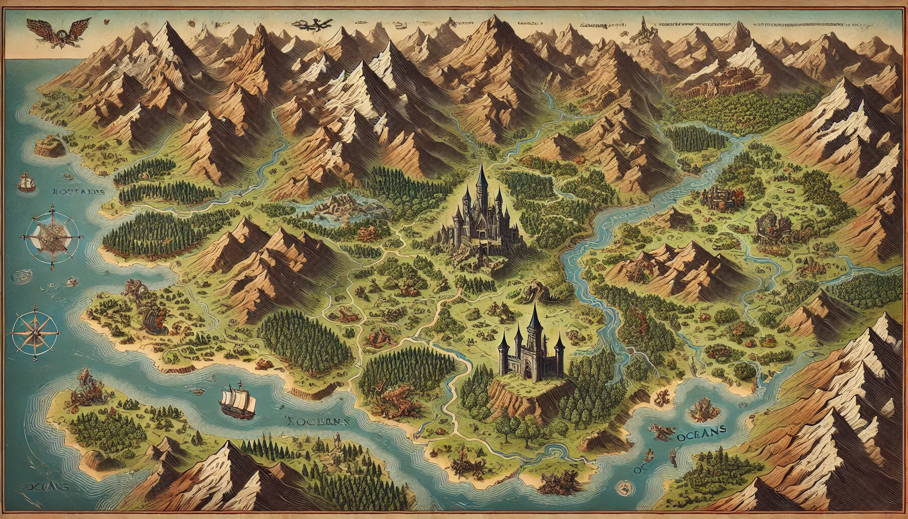
"Antique fantasy continent map, north at top. A west-to-east granite mountain spine feeds three rivers south into a warm inland sea; rain shadow desert on the northeast plateau; oak-and-pine forests on the windward southwest; two gothic citadels on river bluffs; labeled oceans; sailing ships; compass rose lower left; no extra continents, no floating islands."
Step 2: Generate the master atlas and reject geology errors
Ask for one hero map you are willing to treat as canon. Reject anything that sends a river uphill, plants a port in a cliff desert, or invents a second mountain range. That image becomes the reference you describe in later prompts.
"Master atlas of the same continent described above, painterly parchment, readable river mouths, two citadels only, dense forest in the southwest valleys, snow line on the high peaks, same coastline."
Step 3: Zoom without replacing the landmass
From the same bible, request a regional inset, a city harbor, and a battle crop. Say what must not change. If you need a luminous isometric archipelago instead of a parchment continent, lock that as a second atlas with its own bible—do not mix styles in one campaign without saying so.
"Regional inset of the southern citadel only, same river and bluff, 1: city scale, roads to the forest and the sea, no new mountain ranges, battle-map crop of the stone bridge east of the keep, top-down, VTT-readable."
Step 4: Attach lore and play to the same terrain
Hand the geography bible to Game Designer Assistant for travel times and encounter logic. Open Roleplay Game Master with the same place-names so the pass, the ford, and the citadel stay canon when the party arrives.
"You are GMing a Neutral-Good river empire on this map. The western citadel is the capital; the eastern citadel is a rival theocracy. Rivers are the only fast travel. Stay consistent with the geography bible. The party is entering the southwest forest road at dusk."
Step 5: Update the world without redrawing the planet
When a city burns or a dam is built, edit one clause in the bible. Do not rewrite the coastline. Generate the new inset as a variation of the master, not as a new continent.
"Same continent, identical coastline and mountain spine. The eastern citadel is now a ruin with a collapsed south tower and a smoke plume. Keep the river course and the western capital unchanged."
Results and Use Cases
📊 Session-zero continent for a new table
- Scenario: Four players need a shared world map before Sunday D&D, plus a forest road battle map for the opener.
- Traditional Approach: A Pinterest collage, three different mountain ranges, and a VTT scene that does not match the handout.
- Jenova: One geography bible, one master atlas, one regional inset, and a bridge crop that still shows the same river.
- Shared style notes keep the party in one visual world
- Place-names on the handout match the VTT
- The GM can generate NPC holdings in the same pass
💼 Indie gazetteer for a paid one-shot
- Scenario: A designer needs a continent endpaper, six location callouts, and a one-page legend for a PDF adventure.
- Traditional Approach: Placeholder silhouettes, or a single commission that covers only the cover.
- Film Screenwriter: Origin copy and visual motifs for each region, with Comic Creator supplying travel plates that still match the atlas.
- Original geography rather than a thinly disguised copyrighted setting
- Dossier layout: routes, biomes, and three signature landmarks
- Art and text stay aligned when a location is revised
📱 Harbor fight on the train before game night
- Scenario: The party diverted to a coastal isle at lunch, the VTT game is at 7, and you only have a phone.
- Traditional Approach: Reuse a forest map and pretend it is a dock, or skip the visual.
- Jenova on iOS or Android: Edit the bible toward an isometric harbor, generate a battle crop, and upload before you reach the table. Speech-to-text helps if you would rather talk the coastline than type it.
- Feature parity with the desktop workspace
- History stays on the campaign, not trapped on one device
- Fast enough for a commute, not a weekend CAD project
🎯 Campaign journal as a vertical recap
- Scenario: After each session you want a three-panel recap players will actually read on their phones, with the same mountain spine in the background.
- Traditional Approach: Bullet notes in a wiki, no geography, fading memory of which river they crossed.
- Webtoon Creator: Vertical recap pages using the same landmarks, with Children's Book Creator as an alternative when you want illustrated “chapter” spreads instead of scroll rhythm.
- The citadel in panel three is still the citadel from session zero
- New dungeons get a one-off inset without mutating the continent
- Recaps become shareable without a separate art pipeline
FAQ
What is a fantasy map generator AI?
A fantasy map generator AI is software that turns a world description into maps you can use: continents, kingdoms, cities, and battlefields. The useful versions keep the same landmass across those scales. On this platform, that means a written geography bible, image generation, and agents that reuse the terrain in gazetteers, sessions, and recaps rather than treating each picture as a one-off.
Is this fantasy map generator AI free?
Yes. There is a Free plan at $0 with core features and limited monthly usage. Paid tiers raise that usage—Plus is $20/month—and add options such as custom model selection. Usage resets on the billing date with no daily cap. Start on Free if you are testing a single continent; move up if you are generating a full atlas plus weekly insets.
How is this different from Azgaar or Inkarnate?
Azgaar’s generator is a procedural world simulator with deep data layers. Inkarnate is a manual stamp-and-paint editor. Both are strong at their jobs. This workflow is the illustrated campaign layer: you describe hydrology and style, generate atlas art, then keep that geography next to Game Designer Assistant and play tools instead of exporting a heightmap into a separate story wiki.
Can I make world maps and battle maps from the same setting?
That is the whole job. Lock mountains, rivers, and coasts in a reusable bible, generate a master atlas, then request insets and top-down crops as variations. If the coastline still drifts, tighten the immutable terrain and state what must not change. For panel-to-panel travel, use Comic Creator or Manga Creator instead of a disconnected one-shot prompt.
Does a fantasy map generator AI work on mobile?
Yes. The platform runs with feature parity on web, iOS, and Android, including synced history. That is the mobile case that matters for RPG prep: generate a harbor fight between work and the session, or dictate a new regional inset with speech-to-text. You do not need a desktop GIS workflow to keep the campaign on-model.
How do I keep geography consistent across a long campaign?
Treat the geography bible as canon, not the latest pretty render. Immutable clauses first: spine, rivers, climate, capital sites. Generate a master you are willing to defend. When the story changes a city, edit one clause and request a variation. Roleplay Game Master should receive the same place-names so play does not invent a second mountain range.
Conclusion
Fantasy tables do not fail for lack of landmasses. They fail when the endpaper, the VTT, and the session refuse to be the same world. A fantasy map generator AI is the fix for that split: a locked geography bible, illustrated maps at every scale the table actually uses, and enough speed to update a citadel when the story burns it down.
Jenova puts that generator next to the agents that need it. Draw the continent, crop the battle map, write the gazetteer, then keep the same terrain consistent in Game Designer Assistant, Roleplay Game Master, and Comic Creator as the campaign grows.
Explore the full agent library at Jenova and generate the map your setting has been missing.
For Developers: Every agent in this article is available programmatically via the Jenova API — build fantasy map, gazetteer, and campaign-geography features into your application with a single integration. Full documentation →